Sea areas:
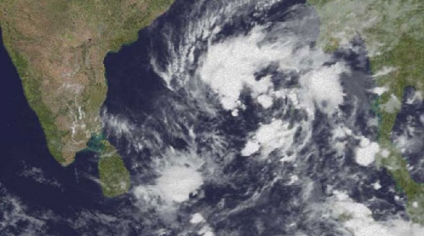
According to the Meteorology Department, the Cyclonic storm ‘GAJA’ over the Central Bay of Bengal is now located approximately 900km away from Kankesanturai to the northeast of Sri Lanka, near latitude-13.5N, longitude-87.4E.It is very likely to intensify further into a severe cyclonic storm during next 24 hours and move nearly westwards during next 12 hours and then west-southwestwards.Naval and fishing communities in the Bay of Bengal sea area are advised to be vigilant in this regards.Showers or thundershowers can be expected at a few places in the sea areas extending from Pottuvil to Kankesanturai via Trincomalee.Winds will be North-westerly over the sea areas around the island. Winds speed will be 30-40 kmph over sea areas around the island.The sea areas to the South-west and East of the island can be fairly rough at times as the wind speed can increase up to 45-50 kmph at times.Temporarily strong gusty winds (up to 70-80 kmph) and rough seas can be expected during thundershowers.
Mainly fair weather will prevail over most parts of the island.Fairly strong gusty winds up to (40-45) kmph can be expected in Eastern, Western and Southern provinces and in the Badulla and Kegalle districts.Misty conditions may occur at some places in the Central, Sabaragamuwa and Western provinces during the morning.
WEATHER FORECAST FOR SEA AREAS AROUND THE ISLAND DURING
The Cyclonic storm ‘GAJA’ over the Central Bay of Bengal is now located approximately 900km away from Kankasanturai to the northeast of Sri Lanka, near latitude-13.5N, Longitude-87.4E. It is very likely to intensify further into a Severe Cyclonic Storm during next 24 hours and move nearly westwards during next 12 hours and then west-southwestwards.Naval and fishing communities in the Bay of Bengal sea area are advised to be vigilant in this regards.Showers or thundershowers can be expected at a few places in the sea areas extending from Pottuvil to Kankasanturai via Trincomalee.Winds will be North-westerly over the sea areas around the island. Winds speed will be 30-40 kmph over sea areas around the island.
The sea areas to the South-west and East of the island can be fairly rough at times as the wind speed can increase up to 45-50 kmph at times.Temporarily strong gusty winds (up to 70-80 kmph) and rough seas can be expected during thundershowers.


